uSHOW — Everyone can publish within minutes!
Featuring Smart-Geolocation, Photos, and Street Address
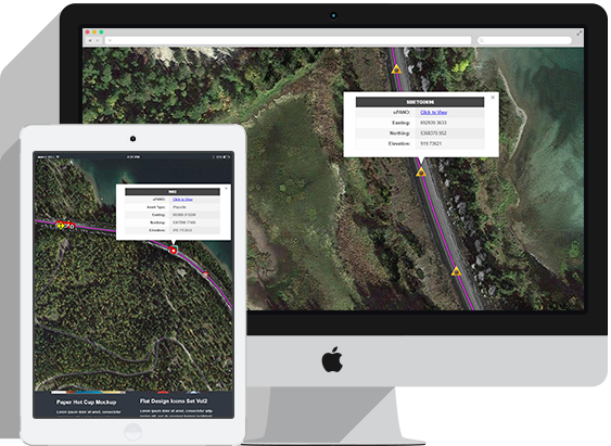
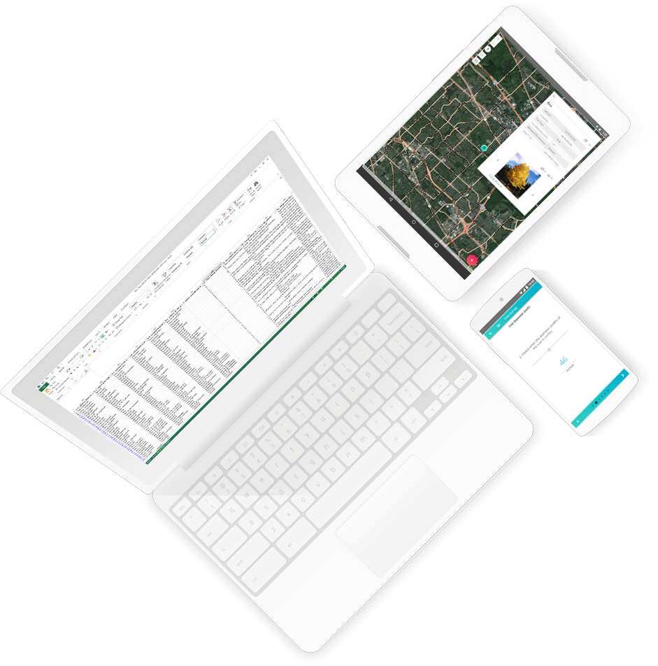
uSHOW is a product that publishes customers’ data over an interactive map. It preserves the data’s original referencing system (i.e. XYZ coordinates) and converts them to the World Geodetic System (WGS 84) so that everything on uGRIDD is somewhere in one world. The deliverable of uSHOW comes in the form of a unique URL. The URL can be protected by uGRIDD username and password. Users can view the map via email invitation with the URL and invitation code. uSHOW also provides HTML codes that can be inserted into your website. Multiple uSHOW deliverables can be combined into one with layer toggles, icons, data searching and editing capabilities.
Multimedia Data Formats Supported
uSHOW supports most of the data types as the usual deliverables in the infrastructure design, construction and operation processes.
In particular, uSHOW supports tabular data, KML, Video, Photo, Shapefiles, LiDAR data (with uPANO), CAD files in 2D and 3D (with uPANO), Aerial Maps, and Engineering plans, etc.Infrastructure professionals upload and publish their data, one dataset at a time. Data in tabular, LiDAR, Aerial map, KML, photo, video and shapefiles formats is processed and published using uGRIDD online tools. Other data, such as mobile LiDAR, CAD/BIM, alignment (linear reference system, aka LRS) and panoramic photos can be sent to uGRIDD for processing and publishing.
Intelligent Map Viewers
Powerful Visualization Tools that Allow Users to Make Better Decisions with their Data
Featuring:
- An online tool that combines multiple data sets into one map
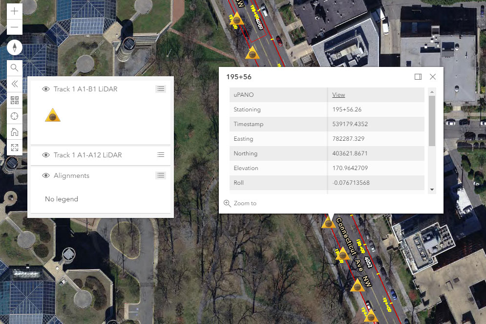
By combining uSHOW map pages, user have unlimited options to create GIS alike maps on the uGRIDD platform. For example, a floor plan can be combined with LiDAR scanning locations, or survey control points be shown together with a CAD drawing for sewer pipelines, drainage systems, outflows, manholes, or any type of asset in one map.
- Multiple data layers with legends
With the multiple uSHOW data layers on one combined map, the uGRIDD platform automatically creates a legend and layer list. Users can toggle a layer on and off using the layer list. This is especially useful to fuse data by its geolocation. uSHOW carries the data’s original coordinates and accuracy so that all data is presented precisely.
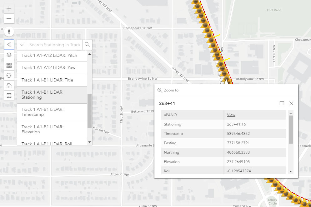
- Search by attribute
A search bar that allows users to find specific records based on attributes of their choice. This is very usefully in large data sets to find a specific group of records.
- Current Location
Users can press a single button to “fly” the map to his current location reported by the internet browser. This is handy in field as the available data is following the user’s location on his device.
Utility
The uSHOW product can be utilized as follows:
- Infrastructure project data sharing
- Operation and maintenance location data interface and navigation
- Data fusion and analysis sandbox
- Location-based data collection and sharing platform
- Interface with third party GIS
SECURITY
Private maps
Any data uploaded by users can be secured with private maps with invitation code. In our management interface, users can create, revoke, and monitor the usage of resources based on tokens.
Account security
We serve our website exclusively via HTTPS, and serve all our APIs over HTTPS by default. We allow user creating multiple customizable access tokens for granular control over access to your account resources.
Data security
All customer data is stored with at least dual redundancy and we've designed our storage solution for 99.99% long term durability. uGRIDD Enterprise accounts come with built-in AES256 encryption-at-rest.