Low-Cost GIS and Management Tool for
Infrastructure and Land Data
Make better interactive web-based maps with your data!
- No hardware or software investments
- No specialized training required
- Total cloud-based applications that reduce costs
- Easy data implementation and maintenance
- Low-Cost and easy to use field data collection (uCOLLECT) Learn more about uCOLLECT


Customer Benefits

- Cost savings on hardware, software and personnel
- Instantly share data with your stakeholders, consultants, or even the general public
- Cloud computation with scalability, flexibility, efficiency and security
- Easy to use interface
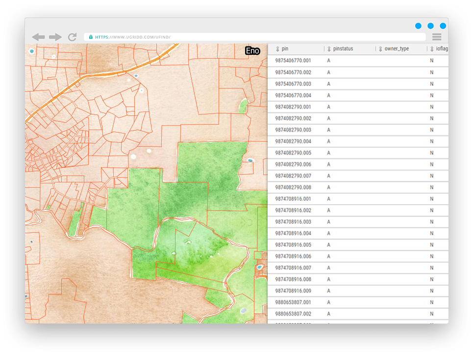
- Support for all data referencing systems, such as WGS 84, SPCS, LRS and more

Potential Uses for uGRIDD:
- Collecting data by your staff and requests from your constituent
- Bridging different governmental offices, agencies, and/or contractors with a big data platform
- Sharing data with real estate developers, business, or community stakeholders with a simple e-mail
- Accessing to your data in the field, including editing features
- Creating maps that can easily be linked or embedded on your website
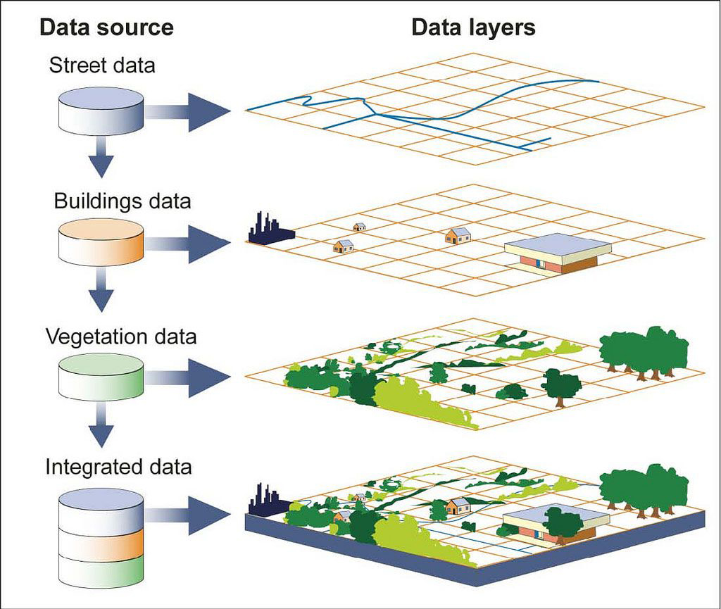
- Visualizing up to 600 different layers of data, regardless of their source
Data Collection, Implementation and Maintenance by Anyone
- Initial data implementation from your excel spread sheet, access database and/or GIS database
- Georeferencing your data
- Customized Add/Delete/Edit interface
- Integration with your Management Information Systems (MIS)
Learn More
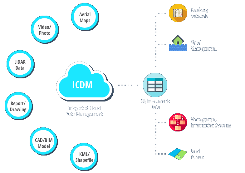
Where the data is from
- uCOLLECT - Field Data Collection Solution
- Your current GIS, excel table, and database systems
- Asset management and other MIS
- Public utility and other service providers
- Capital project data from survey, design and as-built
Learn more

uCOLLECT — Field Data Collection Solution with your Smart Phone
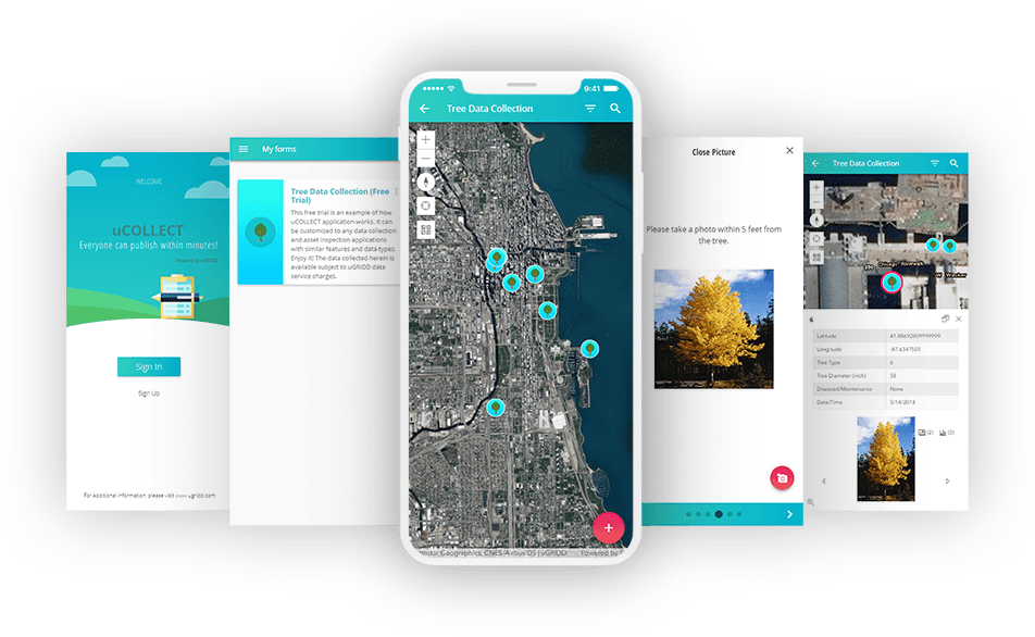
The uCOLLECT solution is a simple, easy, and cost effective way to collect basic data in the field using a smart phone. The uCOLLECT solution is completely customizeable to each user’s needs. It includes a survey using multiple choice, numerical, or short-answer questions, as well as capturing photos and locations. Applications under the uCOLLECT solution can be accessed by employees, authorized users, or even members of the general public on many uses, for example:
Learn more
- Performing inspections
- Surveying trees for removal
- Identifying assets such as sidewalks, pot-holes, or street lights for repair
- Receiving constituent requests
- Creating work orders, and/or verifying maintenance has been completed
Learn more
Integration with Management Information Systems (MIS)
- Georeference the key fields in your MIS
- Link and track your project data by location of interest (LOI)
- Instantly organize your data on map
- Access MIS data from uGRIDD maps
- Use maps to easily and quickly make decisions