Automatic and Precise
Rail Car Clearance Envelop
Computations
A cost-saving solution for the railroad and transit industry
- Benefits all phases of the infrastructure life cycle
- Bridges isolated departmental data silos
- Integrates exiting operation control systems
Request consultation
Our Approaches
A combination of IoT technology and old school engineering
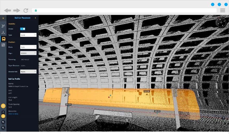
On-the-fly Rail Car Clearance Computation
- 3D rail car profile is automatically placed when a point of LOI (location of interest) is picked;
- The worst scenario location is determined and reported including the front, middle and rear point car positions
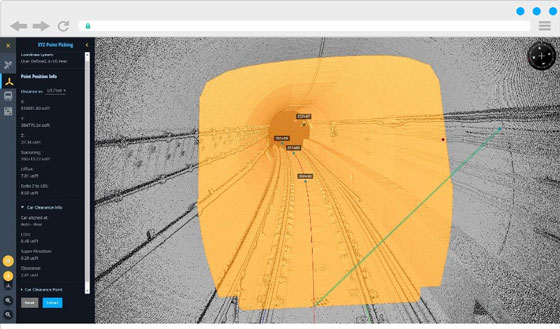
- LOI and rail car clearance points are reported including X, Y, Z (elevation), stationing, offset, and elevation relative to track profile
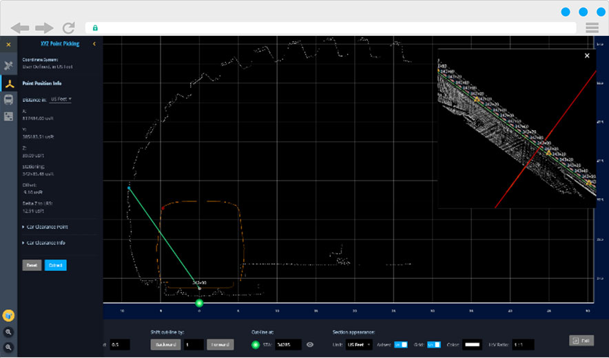
View, measure, and extract LiDAR and CAD data in cross-section view on your web browser
- On the fly cross-section generation
- Dynamic view adjustment.
- 3D LRS (alignment) support
- Multiple horizontal and vertical scale ratios
Rail Car Travel Clearance Envelop Calculation On The Clouds
- All initial data is hosted on the uGRIDD platform
- User specifies the interval of rail car profile placements, i.e. every 5 feet; uGRIDD “adds” all placements into a maximum 3D model, and delivers the travel envelop
- uGRIDD performs the calculations using the inputted parameters;
- User receives an email notification with download instructions for the 3D CAD file results.
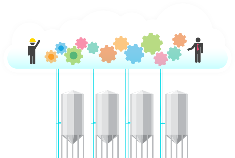
A Powerful Cloud-Based Infrastructure Big Data Platform
COLLECT • SHARE • INTEGRATE • MANAGE Your Infrastructure Big Data Through Georeferencing
Everyone can publish
Everyone can publish within minutes! Map based data visualization & Cloud data archive, optimized solution for infrastructure project. Sharing data/information with team members is essential to the success of your project. The tools in this solution enables everyone to efficiently publish and share your data as easy as 1-2-3!
Upload
Georef
publish
Everything is somewhere!
To quickly find exiting data, LOI based query is the the most efficient way to do so as all infrastructure has its own location.
Learn More
Find
Visualize
Utilize
Learn More

Challenges with Today’s Infrastructure Big Data
- Legacy data exists in isolated data silos
- Lack of efficient ways to search and visualize data
- Rapid change in data collection and processing technology
- Substantial time and millions in cost are expended to find or recreate data that may exist
- GIS technology can only help with well-defined procedures. It typically cannot track and find the raw data you need for your next project.
- File folder technology is also limited.
The uGRIDD Solution
A platform that bridges the data silos
Published project data links, together with enterprise database can be found by selecting a location of interest (LOI) on the map and filtered with additional query conditions.
The uGRIDD Platform Creates Cost Savings by:
- Making asset data easily available throughout the infrastructure lifecycle
- Improving change management
- Accessing to project data in MIS
- Increasing productivity up to 35% - A $1 investment in uGRIDD can result in an average cost savings of $4>